Geologic Mapping of the 7.5 Minute Charleston Quadrangle, Tallahatchie County, Mississippi, and Resource Analysis of the Pre-Loess Gravel
This project, funded by the U.S. Geological Survey through the educational component of the National Cooperative Geologic Mapping Program (EDMAP). Over the course of the project a geologic engineering M.S. student learned the various geologic mapping skills and techniques field geologists use to create geologic maps. The project resulted in a 1:24,000 geologic map of the Charleston quadrangle.
Charleston EDMAP Project Summary
Hydrologic Investigation of Subsurface Stratigraphy Using Ground Penetrating Radar in Southwestern Shelby County, Tennessee
The MMRI in collaboration with the University of Memphis acquired GPR profiles at municipal water well fields to detect potential breaches in the aquitard that would allow contaminants to be transported into the municipal water supply.
GPR imaging of aquitards in Memphis project summary
Testing the feasibility of using ground penetrating radar on floodplain lakes for Lacustrine Paleoseismology
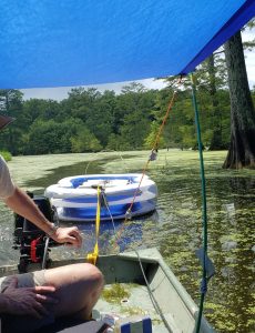
Using a boat borrowed from the University of Memphis and an inflatable swimming pool, Dr. Counts from the MMRI and Tom Pratt from the USGS Geologic Hazards Science Center used an 80 MHz hyperstacking GPR antenna to collected multiple profiles across 5 floodplain lakes in the New Madrid seismic zone to look for evidence of paleoliquefaction in the lake bottoms and to help select possible lake coring sites.
Geology and Engineering Analysis for Economic Planning in the Blue Springs, Mississippi Area
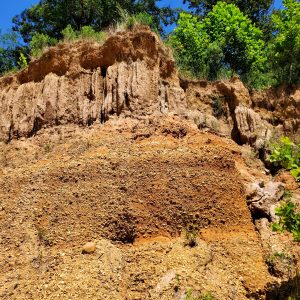
This project acquired and summarized geological and geotechnical data for the responsible growth and development of the Blue Springs region due to the siting of a Toyota automotive manufacturing plant in the town of Blue Springs.
Blue Springs project overview
Compilation of Geological Information for the Richton Salt Dome, Perry County, Mississippi
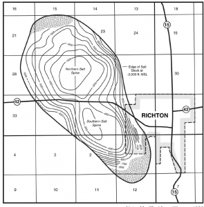
The Richton Salt Dome, located in Perry County, Mississippi, underlies parts of the town of Richton, Mississippi and represents a significant, undeveloped mineral resource. The Mississippi Mineral Resources Institute compiled geological data that can be used to promote its economic development. This compilation provides a source of information and a guide to the governmental and professional literature and includes hydrocarbon well data, sulfur exploration well data, and wells drilled by the U.S. Department of Energy contractors.
Richton Salt Dome project summary
Oxford Tree Canopy Study 2015
Tree canopy changes between the period of 2009 and 2015 were evaluated for Oxford, Mississippi. The Mississippi Mineral Resources Institute worked with the Oxford Tree Board to evaluate the tree canopy changes since the previous canopy study performed in 2009.
Summary to be posted soon
Developing an Acoustic Imaging System for the Shallow Subsurface of the Seafloor: A Polarity Preserving Chirp Sub-bottom Profiler
The goal of the project is to develop an acoustic imaging system to investigate the shallow subsurface of the seafloor in areas with gaseous sediments.
Polarity Preserving Chirp Project Summary


