Ron Counts
Associate Director, MMRI
Associate Professor, Geology and Geological Engineering
rcounts@olemiss.edu
662-915-7320
48 Brevard Hall, University, MS 38677
Research Website
Dr. Counts was appointed Associate Director of the MMRI on October 1st, 2018. Before coming to the MMRI, he spent 4 years as a Research Geologist with the Eastern Geology and Paleoclimate Science Center at the USGS, and 12 years as a field geologist and geologic mapper with the Kentucky Geological Survey at the University of Kentucky.
Experience
Education
Research interests
Dr. Counts does research over a broad range of related topics, but it centers around understanding the dynamics behind paleoenvironmental changes and landscape evolution due to natural geologic process, climatic fluctuations (gradual and abrupt), near-surface neotectonic deformation, and anthropogenic activities. He uses multidisciplinary research methods that include geologic and geomorphic mapping, geospatial landscape analyses, luminescence (OSL, TL) and terrestrial cosmogenic nuclide (TCN) geochronology, sediment coring with the UM Giddings drill rig, detailed core characterizations in the UM Core Analysis and Paleoenvironmental Research Laboratory, and a variety of geophysical methods (ground penetrating radar, electrical resistivity, electromagnetics, and seismic) to help construct 3D and 4D system-scale landscape models. He has done fieldwork on the northeastern slopes of the Uinta Mountains of Wyoming, on the Colorado River in the Grand Canyon, in the Himalaya Mountains of northern India, on glaciofluvial landscapes in the Midwestern United States, on the Atlantic coastal plain of South Carolina and Georgia, the Appalachian Piedmont of Georgia, South Carolina, and Virginia, the coastal plain of the Mississippi Embayment, on the island of Hawaii, and in every intraplate seismic zone east of the Rocky Mountains, including the region of the 1886 Charleston, South Carolina, earthquake.
Current research
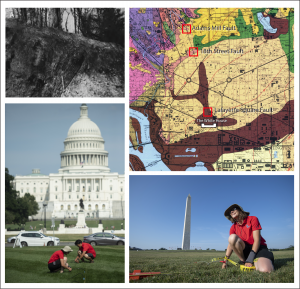
Mapping a Quaternary fault beneath the National Mall and Memorial Parks using electrical resistivity and testing the efficacy of passive seismic methods in dense urban settings, Washington, D.C.
Phase 1 of this project completed by M.S. student: Kristian Macias, 2020-2022
Collaborators: U.S. Geological Survey Earthquake Hazards (Tom Pratt), U.S. Geological Survey Luminescence Dating Lab (Shannon Mahan)
The first phase of this project used ground penetrating radar, electrical resistivity, and refraction microtremor seismic (ReMi) to map a fault inferred to lie under our nation’s capital on published USGS maps. The fault location is based on three known fault exposures in DC, but whether these are small, local uplifts or one, continuous fault is uncertain. Luminescence dating from a hand-dug pit at the National Zoo in 2018 indicates the gravel is ~350 ka. A new pit was dug in the coarse-cobble gravel, and a second luminescence sample was collected to verify the relatively young age of the fault.
Washington, D.C. fault project summary
Characterizing middle Pleistocene paleoclimate variations and evolution of the Mississippi River Valley using tephra geochemistry and cosmogenic burial geochronology on the Mississippi River Upland gravel complex
Phase 1 of this project completed by M.S. student Trevor Dempsey, 2020-2022
Collaborators: Texas Tech University (Dr. Branimir Segvic), Arkansas Geological Survey (Scott Ausbrooks), Purdue University PRIME Lab
Calibrating subsurface interpretations of airborne electromagnetic data for the Mississippi Valley in northeastern Arkansas using multi-proxy data from continuous cores and optically stimulated luminescence dating
M.S. student: Jodi Messick, 2020-2022
Collaborators: US Geological Survey Lower Mississippi Water Science Center (Burke Minsley, JR Rigby, Ryan Adams), U.S. Geological Survey Luminescence Dating Lab (Shannon Mahan)
This project drilled five continuous (4-inch diameter) rotosonic cores to depths ranging from 45 meters to 110 meters in Eastern Arkansas in the summer of 2021. Two cores were drilled in the Western Lowlands (west of Crowley’s Ridge) and three were drilled in the Eastern Lowlands. The goal of the project is to use data from the cores to help calibrate the AEM data by identifying unknown conductive layers present in the data. Up to 60 luminescence samples will be taken from the cores to determine the ages and aggradational rates of the sediments that comprise the alluvial aquifer.
Are the coarse-grained alluvial fans on the Mississippi valley walls and along Crowley’s Ridge significant recharge zones for the Mississippi Alluvial Aquifer?
PhD. Student Arjun Bhandari, 2022-2026
M.S. Student Anish Dahal, 2022-2024
The Mississippi valley is one of the most productive agricultural areas in the country, and the intensive withdrawal of water from this important natural resource grows every year and is rapidly depleted the water supply. Current research at the USGS and USDA includes studies of induced, or artificial recharge through engineered pathways, yet the recharge through natural pathways has not been fully studied or quantified.
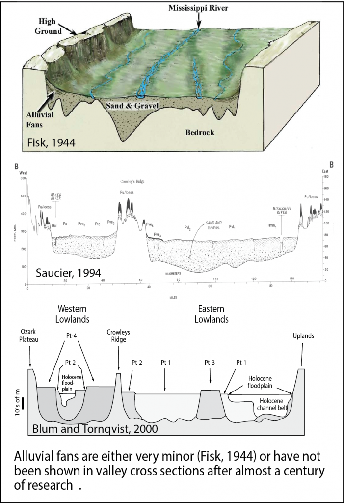
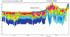
For the past ~75 years, previous researchers have not regarded these fans as significant geologic units, evident by their absence from valley cross sections (see Fisk, 1944, Saucier, 1994, and Blum and Tornqvist, 2000 for examples). However, longitudinal profiles of some of the fan surfaces appear to plunge below the ground, suggesting they may significantly extend into the subsurface (Fig. 2). Furthermore, recent AEM data collected by the USGS (Burton et al., 2019) suggests these fans may be extensive and there are at least two generations of alluvial fans. A smaller, younger (Holocene?) fan at the surface which is underlain by a much larger, thicker, and significantly more extensive pre-Holocene fan. Results from these projects will be a large step towards understanding the hydrogeologic stratigraphy of fans and how they affect recharge to the aquifer.
Upcoming research opportunities for M.S. and Ph.D. students (fall, 2024)
Developing a high-resolution, multi-proxy terrestrial paleoclimate record of the mid-south during the MIS 8 glacial period from loess-paleosol sequences on Crowley’s Ridge.
Collaborators: Texas Tech University (Dr. Branimir Segvic), Arkansas Geological Survey (Scott Ausbrooks), Illinois State Geological Survey (Dave Grimley, Sebastien Huot)
Ph.D. student needed
Full tuition waiver and a Teaching Assistantship available, Research Assistantship may be available from pending grant
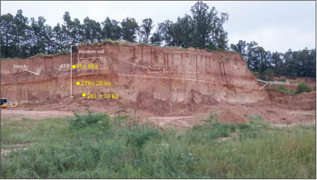
This thick loess section on Crowley’s Ridge was deposited during MIS 8 and MIS 5c. Younger loess deposits are absent or very thin.
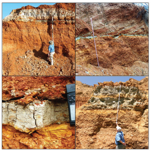
Luminescence dating revealed that nearly half of a 20 meter thick loess section on Crowleys Ridge was deposited during MIS 8, making it one of the thickest known sections from a glacial stage in the Mississippi River valley that very little detail is known for. This project will collaborate with multiple researchers from other universities and will include detailed sampling of the loess for analyses that will include total carbonate, magnetic susceptibility, XRD, XRF, spectrophotometry, particle size, stable oxygen and carbon isotopes, gastropods identifications, luminescence dating, and the analyses of detrital zircons and pollen.
Where is the fault that produced the 1886 Charleston, South Carolina earthquake?
Collaborators: U.S. Geological Survey Earthquake Hazards
M.S or PhD. student needed
Full tuition waiver and a Teaching Assistantship available, Research Assistantship may be available pending future funding
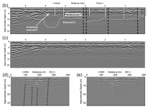
The fault that produced the Mw 7 earthquake in Charleston, South Carolina in 1886 remains unidentified, and in fact there are multiple competing models for where faults even exist in the Charleston area. Preliminary ground penetrating radar (GPR) data combined with reprocessed seismic data has identified several near-surface faults in the area. This project will build on that research and use high-resolution GPR and ER surveys to pinpoint faulted coastal plain horizons, drill sediment cores of the faulted horizons, use luminescence dating, and possibly open a trench for the purposes of locating the fault that produced the strongest historic earthquake to strike the eastern seaboard.
GPR profiles from the Charleston area. Dashed lines are faults identified in seismic reflection data.
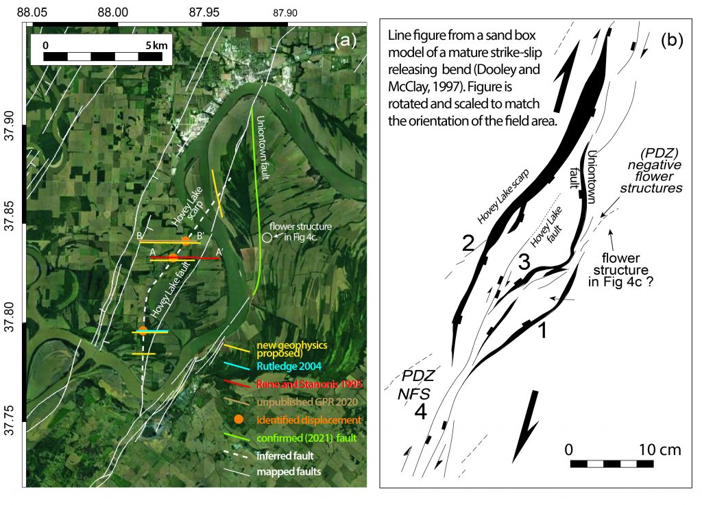
Investigating the Hovey lake fault system in the Wabash Valley seismic zone (WVSZ): understanding how Paleozoic structures created in a different stress regime are deformed by Holocene reactivation
Collaborators: U.S. Geological Survey Earthquake Hazards (Bill Stephenson), University of Kentucky (Dr. Ed Woolery)
M.S or PhD. student needed
Full tuition waiver and a Teaching Assistantship available, 1-year Research Assistantship may be available pending grant funding
Recently published research (Counts et al., 2021) identified a Holocene fault in the WVSZ that produced a >Mw 6.5 earthquake 3,500 years ago, which appears to be part of a large, reactivated structure. This project will build on that research and do a paleoseismic investigation of the Hovey lake fault using drilling, geophysics, luminescence dating, and trenching.
PUBLICATIONS
