The Mississippi Mineral Resources Institute (MMRI) was established in 1972 by the Board of Trustees of the State Institutions of Higher Learning (IHL) in an effort to coordinate mineral-related research in Mississippi

Dr. Velon H. Minshew, the first director of MMRI (from 1972-1982), was instrumental in its establishment. In the first few years of the institute, important geologic commodities such as clays, sands, and lignite deposits were studied throughout the state. These early lignite studies provided important foundational information which aided the development of the Red Hills lignite mine and power plant in Ackerman, Mississippi. Pivotal work performed for these studies came from students, and mentoring and supporting students has been an important element of our mission from the very beginning.

When Minshew left his role as director to enter into the private sector, Dr. James Robert (Bob) Woolsey became the new director (from 1982-2008) after having worked at the University of Mississippi for two years prior. Under Woolsey’s leadership, studies of the mineral resources of the state continued and were joined by Mississippi coastal and offshore evaluations. Woolsey acquired the research vessel Kit Jones for use in the nearshore Gulf of Mexico, and its wooden hull allowed for acoustic surveys to be performed on the seabed. MMRI worked with the Minerals Management Service, now known as the Bureau of Ocean Energy Management (BOEM), on projects ranging from shell resources to gas hydrates. Woolsey died tragically in 2008 and an interim director was in place until January 2010.

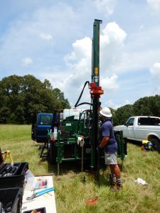
Dr. Gregory L. Easson became MMRI director (from 2010 to 2023) and merged his existing research organization, the University of Mississippi Geoinformatics Center, with MMRI. This brought additional remote sensing and Geographic Information Systems (GIS) experience to MMRI. Land use, deforestation, endangered fish habitat mapping, and levee flooding studies are some of the projects that utilized the GIS and remote sensing capabilities. Coastal and deep-water investigations continued and were ramped up due to a major oil well failure near the gas hydrate site that had long been studied by MMRI. With the oil pollution on the shores, more interest in the nearshore marine life prompted oyster studies with landers used to collect water quality data for months at a time. Terrestrial studies continue, and MMRI recently assisted with determining the reserve of an operating bentonite mine. The acquisition of a Giddings drill rig, which is shared with the Department of Geological and Geological Engineering, was an important addition to the institute. An investigation of heavy minerals in Upper Cretaceous through lower Eocene sands of north Mississippi is ongoing. A cooperative study with the USGS this summer (2021) to examine a potential fault under the Washington Monument, the Capitol Building, and other important structures in Washington, D.C. utilized geophysical methods to image the subsurface, and data is currently being processed.

With over 50 years of dedication to the state of Mississippi, it is difficult to mention all of MMRI’s projects and affiliations. Federal, state and local governments, Mississippi Department of Environmental Quality (MDEQ), federal and state emergency management groups, private industry, and others have provided funding and/or support for the varied interests of the institute. Their support has allowed MMRI to continue the important work that started with Dr. Minshew and the IHL.